
|
|
||||||||||||||||||||||||
|
The Geography of Alaska
Additional Geographic Themes
Geography Information System specialists have estimated that approximately eighty percent of all data can be mapped; that is, the data has spatial characteristics. Much of what follows in this Alaska Studies program, history, civics, economics, resources and cultural studies all have a geographic component. Here we will look briefly at three additional geographic themeshuman systems, environment and society, and geography and history. Human Geography How are people, their social organizations, and what they build (infrastructure) distributed in Alaska? Obviously, they are not all evenly distributed across the state. The variations have significant impacts on our different ways of life and quality of life. Consider one examplethe building of a road from Anchorage or Fairbanks to Bethel or Nome. What would be the impacts of the road(s) on the environment, the local communities, or the economy of the region affected? 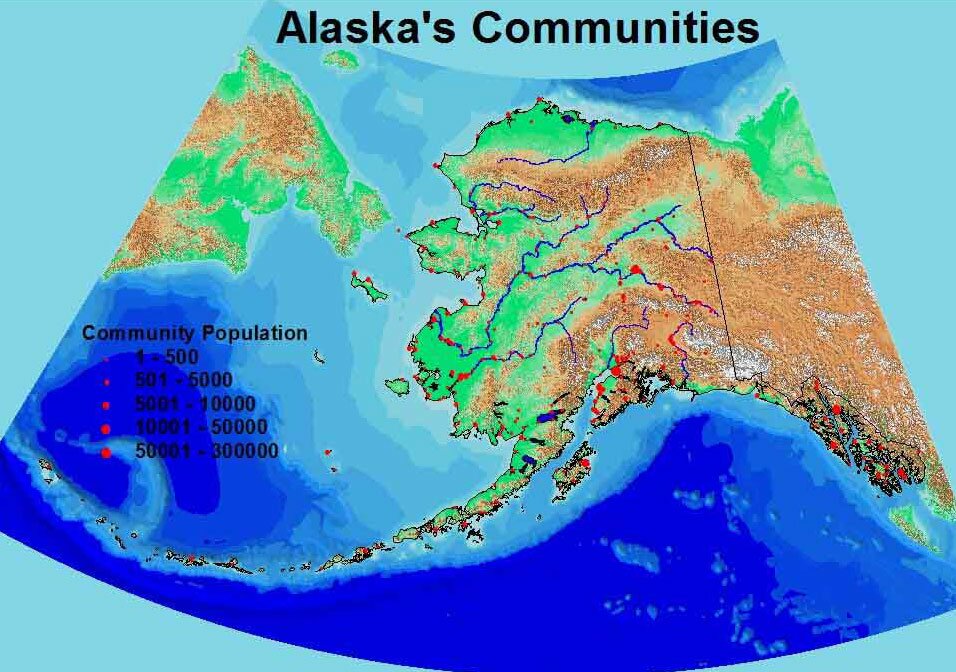 Figure OG.1 - Alaskas Communities The location of small communities along major river systems, such as the Yukon River and the Kuskokwim River and coastal areas, such as Southwest Alaska, reflect the distribution of traditional Native settlements and early Russian and American settlements. The dominance of major centers is suggested as well. The census defined urbanized areas of Anchorage (250,000), Fairbanks (52,000), and Juneau (25,000) together constitute half (52 percent) of Alaskas population. Overall, according to the U.S. Census, urban Alaska accounts for two-thirds of the states total population. 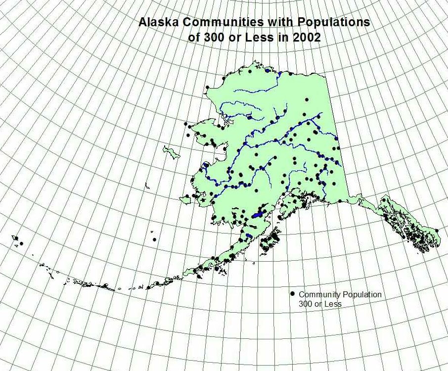 Figure OG.2 - Communities with Populations of 300 or Less Environment and Society This theme explores the geographic relationships between people and the physical environment. Three key questions are:
A geographic example of the first case might focus on the degree to which Alaska National Interest Lands (created in 1980) overlap zones of high mineral potential and the access routes to those zones. Once mineral zones and deposits are mapped (Figure G.1) they can be geographically compared to the locations of the ANILCA lands. Once this information is analyzed policy and value questions can be addressed, such as do ANILCA lands hinder Alaskas mineral resource development? What are the benefits and costs of having approximately one-third of Alaskas land area as federally reserved? One of the major issues facing Alaskans is the manner and extent to which they impact the environment. The question of whether or not to develop the petroleum resources of the Arctic National Wildlife Reserve hinges largely on the potential negative impacts of resource development. Another example would be the actions of various state and federal agencies towards subsistence and sport hunting and fishing. 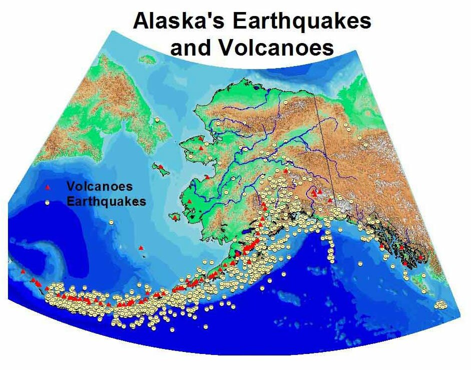 Figure OG.3 - Alaskas Earthquakes and Volcanoes Similarly, most of Alaskas villages are located along rivers or coastlines (Figure OG.1). Consequently, 184 of these communities face serious flooding problems. Should these communities be moved? If so, the costs, both economically and psychologically, would be enormous. If they are not moved, then what reasonable flood preventive measures can be utilized? Geography and History Simply stated, geography studies where then history studies when. The two disciplines are complementary. We might think of geographers studying the geography of then rather than the geography of now. Geographers might look at how Alaskas road system has developed since the late 1800s or the rise of Anchorage from an unsettled area to the largest urban center in the state. Geographers are also interested in studying how the past has influenced todays landscape. One example of such a study would be the geography of place names or toponymy. Alaska has a rich blend of place names. (See Shem Pete biography.) The North Slope Borough, for example has been geographically coding all the Inupiat names of features in the borough. Other names can be related to certain historical events, such as Telegraph Creek which came from the telegraph survey of the 1850s. We find Russian names in areas once inhabited by people from the Russian American Company (Ninilchik) or recent Russian settlers (Nikolaevsk). The growth of the fishing industry and the gold mining industry have produced a wealth of names for physical features such as rivers, coves, and mountains and for communities and even roads in communities.
|
||||||||||||||||
|
